Tallapoosa River and Canoe Trails

Located at the southern end of the Appalachian Mountains, the Tallapoosa River winds 258 miles from western Georgia into eastern Alabama. The river gets its name from the people who lived along the lower stretch of it in the eighteenth century. The Tallapoosa flows through stretches of lush countryside that help preserve its natural beauty and solitude. The Tallapoosa is so unique that the Alabama section has been designated a part of the Alabama Scenic River Trail.

Naturalists, historians, and adventurers are quick to point out that the crown jewel of the Tallapoosa River lies in east central Alabama within the borders of Tallapoosa and Chambers Counties. Along a 25-mile stretch of water, visitors discover the tranquility in a mighty waterway that winds and spills along the Piedmont. Pause along your journey to witness the unique perspective of a fierce battle fought long ago and wonder in the beauty of the shoal lily while catching a glimpse of a soaring bald eagle.

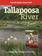
Welcome to the Harold Banks Canoe Trail!

A peaceful, family friendly adventure, the trail is a combination of flat water and shoals rarely above class I (easy) in the International Scale of River Difficulty. But the level, flow, and volume of the Tallapoosa River are seasonal and dictated by Alabama Power and its hydroelectric Harris Dam located upstream near Wedowee, Alabama. Paddlers are strongly encouraged to monitor the online water level gauges kept by the U.S. Geological Service at the Wadley Bridge and Horseshoe Bend Bridge.

The Tallapoosa County Canoe Trail is divided into three sections and manageable float trips:

(8.25 miles, 5-hour float) begins with public access at Bibby’s Ferry, just across the Tallapoosa County line in Chambers County, and ends with public access at Germany’s Ferry Bridge. This section features unique spots such at the Baptistry and the Fish Trap, brisk shoals, great fishing, a campsite, and stretches of flat water paddling.

Bibby’s Ferry Access
12449 Germany’s Ferry Road
Daviston, Alabama 36256

(9.75 miles, 6-hour float) begins with public access at Germany’s Ferry Bridge and ends with public access at Horseshoe Bend Bridge. This middle section begins with blue water paddling and includes fishing spots, mile-long Griffin Shoals, with a brisk side channel, and ends with reminiscent paddling through historic Horseshoe Bend National Military Park.

Germany’s Ferry Access
1387 Germany’s Ferry Road
Daviston, Alabama 36256

(6 miles, 4-hour float) is the most popular and considered by many to be the most scenic. It begins with public access at Horseshoe Bend Bridge and ends at Jay Bird Creek public access. This lower section has several patches of Shoal or Cahaba lilies, is known to have bald eagles in the area, and features Peters Island, Laura’s Leap, side chutes, Irwin Shoals, and campsite at Jay Bird Creek. Bear left or right to take the swift side chutes for more excitement.

Horseshoe Bend Access
10689 Horseshoe Bend Road (Hwy 49 North)
Daviston, Alabama 36256

Harold Banks is a man of many talents – historian, forester, storyteller, explorer, and outdoorsman. But in Tallapoosa County, he is best known for his red canoe and his expertise on the river. In 2009, he became the first person to solo paddle the entire 258 miles of the Tallapoosa River from its origins in Paulding County, Georgia, to its end at Fort Toulouse near Wetumpka, Alabama. In 2015, the 25-mile stretch of the river located in Tallapoosa and Chambers Counties and cherished by Harold was named in his honor. He resides in Dadeville, Alabama.